by Matt Mann, Reseach Program Coordinator
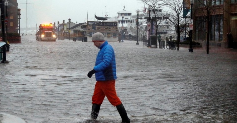
As weather events become more extreme, MassDOT and Massachusetts communities, especially those on the coast, recognize their infrastructure is vulnerable. Coastal cities and towns are currently grappling with the extreme climate impacts of higher temperatures, increased extreme precipitation and greater amounts of sea level rise. All of these impacts are not new, they have slowly been occurring over the past century. It is predicted these changes will accelerate and increases will happen over a shorter length of time (e.g. by 2030, the sea level could rise by 4”-8” (BRAG Report, 2016)).
MassDOT and Climate Ready Boston presented at the April 2018 MassDOT Innovation and Mobility Exchange on the impacts to transportation assets and infrastructure, and strategies to better accommodate climate change. Mia Mansfield, Climate Ready Boston, presented on goals to guide Boston’s future growth:
- Goal 1: Provide quality of life in accessible neighborhoods
- Goal 2: Drive inclusive economic growth
- Goal 3: Promote a healthy environment and adapt to climate change, and
- Goal 4: Invest in infrastructure, open space and culture
Associated with these goals are planning and implementation projects for creating resilient infrastructure and buildings, preparing communities, and protecting shorelines. The feedback from the public outreach on what types of flood ready improvements the public would like to see included expanding open space, berm development, and flood walls. Project areas Climate Ready Boston has focused on are East Boston, Charlestown, and South Boston. Mansfield spoke about this initiative saying, “The resiliency strategy embraces layered flood control and integrated green infrastructure measures that mitigate the effects of climate change, and create social, environmental, and economic benefits and value to the people of East Boston and Charlestown and to all who share in the health of the city and the harbor.”
The existing transportation assets will be impacted by more flash floods, landslides, and flooding. Further, increased precipitation could have adverse impacts on the infrastructure that helps move the water, especially on culverts. Hongyan Oliver, MassDOT Office of Transportation Planning, and Chris Dorney, WSP USA, presented on MassDOT’s multi-year statewide Climate Adaptation Vulnerability Assessment study. This study aims first to identify a prioritized set of MassDOT transportation assets throughout the Commonwealth that is at high risk for future inland flooding, and second to provide actionable scientific information for adaptive strategies, and future capital and project planning. This second goal begins on a broader planning level and then is developed through a detailed analysis of vulnerable assets. One challenge is mapping statewide future floodplains where vulnerable assets are located. With this challenge in mind, MassDOT is currently conducting a pilot mapping study on a watershed in western Massachusetts. The approach is to prepare georeferenced data, assign slopes, calculate current peak flows and 100-year flows, elevations, and floodplains, and evaluate the asset exposure. Procedures for floodplain mapping will include developing an instruction manual, applying the data management protocol, and automating parts of the process for efficiency.
Next steps after that will include training additional MassDOT staff on the procedures, and applying the pilot study procedures and lessons learned from all other watersheds in the state and sharing the results and data with stakeholders. Eventually, this important information and these strategies can then be incorporated into MassDOT’s project prioritization, capital planning, asset management system, and emergency preparedness procedures.